
The source of the Dollis Brook is in Moat Mount Open Space near the A1 and it flows past Barnet and then south to form the river Brent where it merges with Mutton Brook at Hendon. The Dollis Valley Greenwalk follows the route of the brook and continues to Hampstead Garden Suburb on a waymarked path.
The Dollis Valley Greenway shares the first part of the route with London Loop section 16 and for convenience it seemed sensible to start the day at Elstree and Borehamwood station, joining the Dollis Brook half way along. It is therefore a repeat of my walk on that section in 2019, and since that day had been particularly wet it would be nice to do it in rather more clement weather. The first attempt last week had to be abandoned due to time when I got somewhat lost, hopefully today I would succeed. For information the London Loop and Capital Ring now seems to be managed by the Inner London Ramblers who have recently produced a new series of PDF guides. I used their leaflet for section 16 which includes a couple of alternative routings.
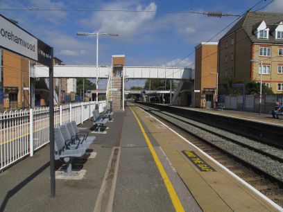
Elstree and Borehamwood station is on the Thameslink line to Luton and there are various options to reach it. The most sensible, and probably quickest, route is to use the new Elizabeth line from Tottenham Court Road and join the train at Farringdon. I just missed the 1029 train so the following one got me there at 1105. It is difficult to reach these outer sections of the Loop much before 11am. Out of the station and through a small residential area to enter Woodcock Hill Village Green following the suggested alternative route that avoids a long stretch of main road walking.
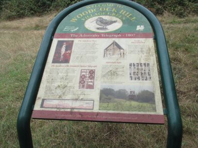
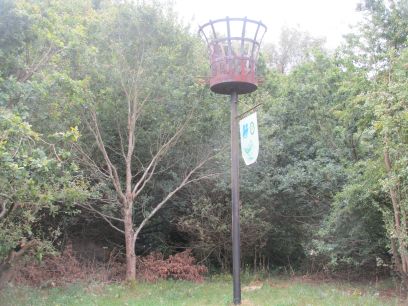
Woodcock Hill Village Green is a pleasant wooded area. At the top of the hill there used to be an Admiralty Telegraph station, part of a visual telegraph system established in 1807 and described in some detail in the plaque. Further on is the Armada beacon, the original being used to pass messages during the Spanish Armada and more later as part of the UK beacon network for royal occasions.
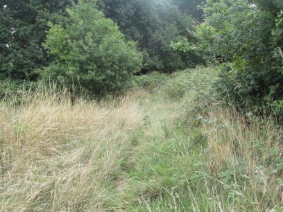
The previous time I walked this route I missed the path through the woods and can now see why. A faint path in the grass is the only evidence it exists. But further on it develops into quite a nice woodland walk until it exits on the busy Barnet Lane which has to be crossed.
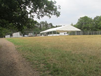
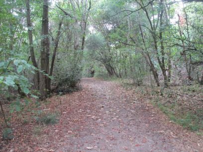
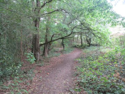
Now into Scratchwood Open Space which would have been a very different place if junction 3 of the M1 and its link road to the A1 had been built, this area of woodland dates back to the last ice age. The path wends its way through the woods to the first clearing that I had wrongly decided was where I should have turned off last week and got totally lost. Today a group of workmen were erecting a huge marquee there, one of them I spoke to thought it was some sort of music festival but wasn't sure. It seems it was for the Summer Jam Festival. But I now knew that I should not go that way so pressed on to the next clearing followed by a lengthy pleasant woodland walk before emerging on the bustling A1.
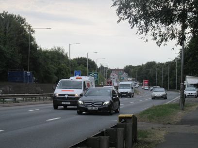
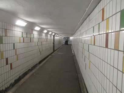
Now follows an unavoidable 650 yards slog along the A1 to reach a subway, built for the adjacent Mill Hill golf course.
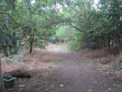
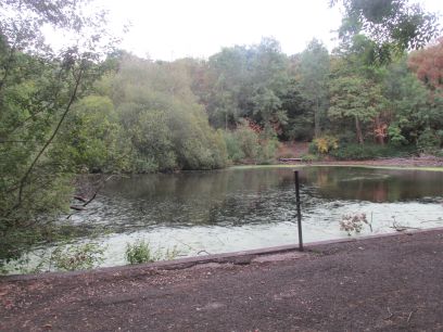
The official London Loop runs 450 yards along the opposite carriageway up to Moat Mount Open Space, but there is now an alternative. A short walk through residential housing and Moat Mount Open Space is entered at its lower end and we can follow a woodland path which even though the noise of the A1 is ever present is a much more pleasant way. On reaching the car park (currently closed) the loop continues further into woodland. I overshot the first turning and reached a lovely pond then had to retrace a short distance.
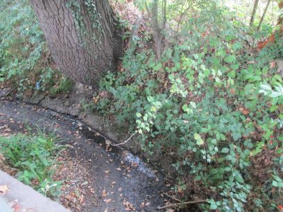
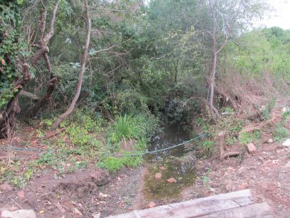
The route continues through Moat Mount Open Space with a mixture of woodland and open space. I missed the pond from which Dollis Brook is sourced but along a stretch of road I met it at last at a bridge. The upper reaches of the Dollis had very little water in them.
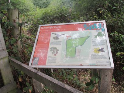
Totteridge Fields is a nature reserve managed by London Wildlife Trust
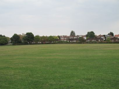
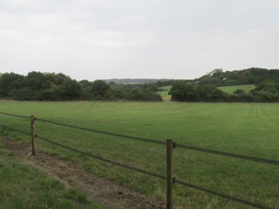
Into King George V fields and the Dollis Brook is followed for a mile or so to the outskirts of Barnet. Here the loop breaks from the brook as that heads south. This marks the end of section 16 and the end of the day's walk. I followed the loop route up to High Barnet where I had a somewhat late lunch in the Queen's Arms before catching the Northern line train back to Waterloo and home after a very pleasant but somewhat tiring day.
Section 2